Campaign ends in
MapMyPlot: drone maps for family land documents
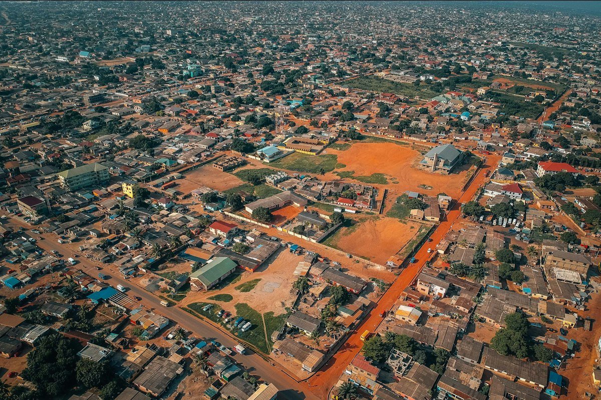
Most family land in our area has never been properly mapped, and a survey costs more than many families can pay. With a drone and a licensed surveyor checking our maps, we can map a plot for a fraction of the cost.
The money buys a mapping drone, software licences and the surveyor's time for the first 200 plots.
This is a fictional demo campaign: the people, figures and contributions are invented. Photo by Virgyl Sowah on Unsplash.
Keep what you raise. The organiser receives every contribution, even if the goal is not reached by the deadline. Backing this campaign is not an investment: you don't receive shares, interest or any other financial return.
How the money will be used
Milestones
-
Drone licence approved
Planned · 9 Nov 2026 -
First 50 plots mapped
Planned · 3 Jan 2027
Risks and challenges
We need a drone permit before flying; the application is in.
Updates
No updates available.
Comments (0)
Leave a Comment
More campaigns like this


SignBridge: an app that translates Ghanaian Sign Language
Goal: GH₵50,000
FarmPulse: soil sensors that text farmers when to water
Goal: GH₵80,000
Share
<iframe class="iframe-field" width="560" height="315" src="https://boxyfund.com/donation/payment/donate/embed/demo-mapmyplot-drone-maps" frameborder="0" allow="accelerometer; autoplay; clipboard-write; encrypted-media; gyroscope; picture-in-picture" allowfullscreen></iframe>